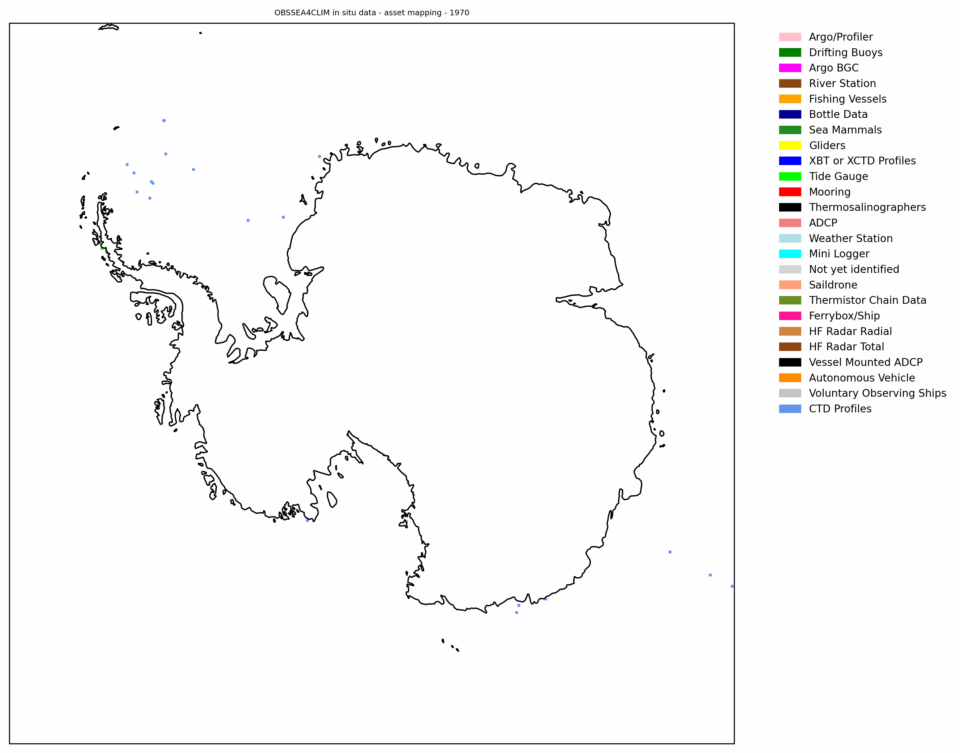
Exploring Polar Ocean Observations
Each point in this animation represents a different observing platform — with colours distinguishing between moored buoys, gliders, animal-borne instruments, ARGO profilers, CTD casts, and more.
What you see are the last recorded positions where each platform collected in situ data during that year. The dataset is drawn from sources available in SOOSmap (via EMODnet Physics).
We know there may be other valuable datasets out there. If you’re aware of additional sources, we’d love your help in making them FAIR (Findable, Accessible, Interoperable, and Reusable) and connected to this growing network.
This consolidation of datasets, across the years and many individual programmes, research centres and nations, is necessary for us to be able to understand the properties of the Southern Ocean; how it varies from season to season and place to place, as well as how it is changing over the decade in response to a melting ice sheet and changing climate. However, there are still big gaps in our understanding, this is particularly the case under the sea ice and in winter closer to the coastline where conditions make it very hard for traditional oceanographic observations to be made. Unfortunately these are also the key areas where many of the important processes that control ice sheet melt, sea ice growth and ocean circulation change happen! However, new technologies, including marine mammal tags, autonomous floats and ocean gliders and submersibles are pushing into these regions to allow us to monitor these climatically critical seas, but much remains to be done!
This mapping is made possible through the collective efforts of SOOS, EMODnet Physics, and the Horizon Europe projects: OCEANICE, OBSEA4CLIM, and POLARIN
The author of the article - Andrew Meijers (British Antarctic Survey) and Antonio Novellino (ETT)